


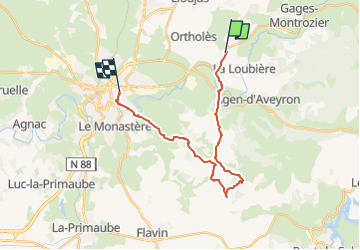
GR62.Boucle RODEZ

aucamus
User

Length
21 km

Max alt
764 m

Uphill gradient
561 m
Km-Effort
29 km

Min alt
526 m

Downhill gradient
525 m
Boucle
No
Creation date :
2025-04-26 08:59:53.631
Updated on :
2025-06-12 10:14:29.215
6h29
Difficulty : Very difficult

FREE GPS app for hiking
 SityTrail
IGN / Geographical institutes
SityTrail Plus
The world is yours!
About
Trail Walking of 21 km to be discovered at Occitania, Aveyron, La Loubière. This trail is proposed by aucamus.
Positioning
Country:
France
Region :
Occitania
Department/Province :
Aveyron
Municipality :
La Loubière
Location:
Unknown
Start:(Dec)
Start:(UTM)
472490 ; 4914003 (31T) N.
Comments